Photographer Robert Burley visualizes Toronto’s defining feature

Photos by photographer and Ryerson professor Robert Burley help illustrate one of the cities sunken treasures — ravines. Pictured: Footpath, Lower Don Parklands. (Photo by Robert Burley, An Enduring Wilderness)
Photographer and professor of image arts Robert Burley invites readers of his book, An Enduring Wilderness, to “get lost” in the green spaces that are often overlooked and forgotten.
Professor Burley’s book of photography, commissioned by the City of Toronto, supports the first ever (PDF file) strategy (external link) for Toronto's ravine system and is a foundational piece in communicating the importance of Toronto’s ravines as wilderness green spaces, community gathering spaces and a refuge from urban life. Four years’ worth of photographic expeditions, from the Scarborough Bluffs to the Etobicoke Creek, culminated in a book and exhibition at the Scotiabank CONTACT Photography Festival. In addition, an archival collection will be stored at City of Toronto Archives as a documentary record of the state of the parks during this era of remarkable growth and change.
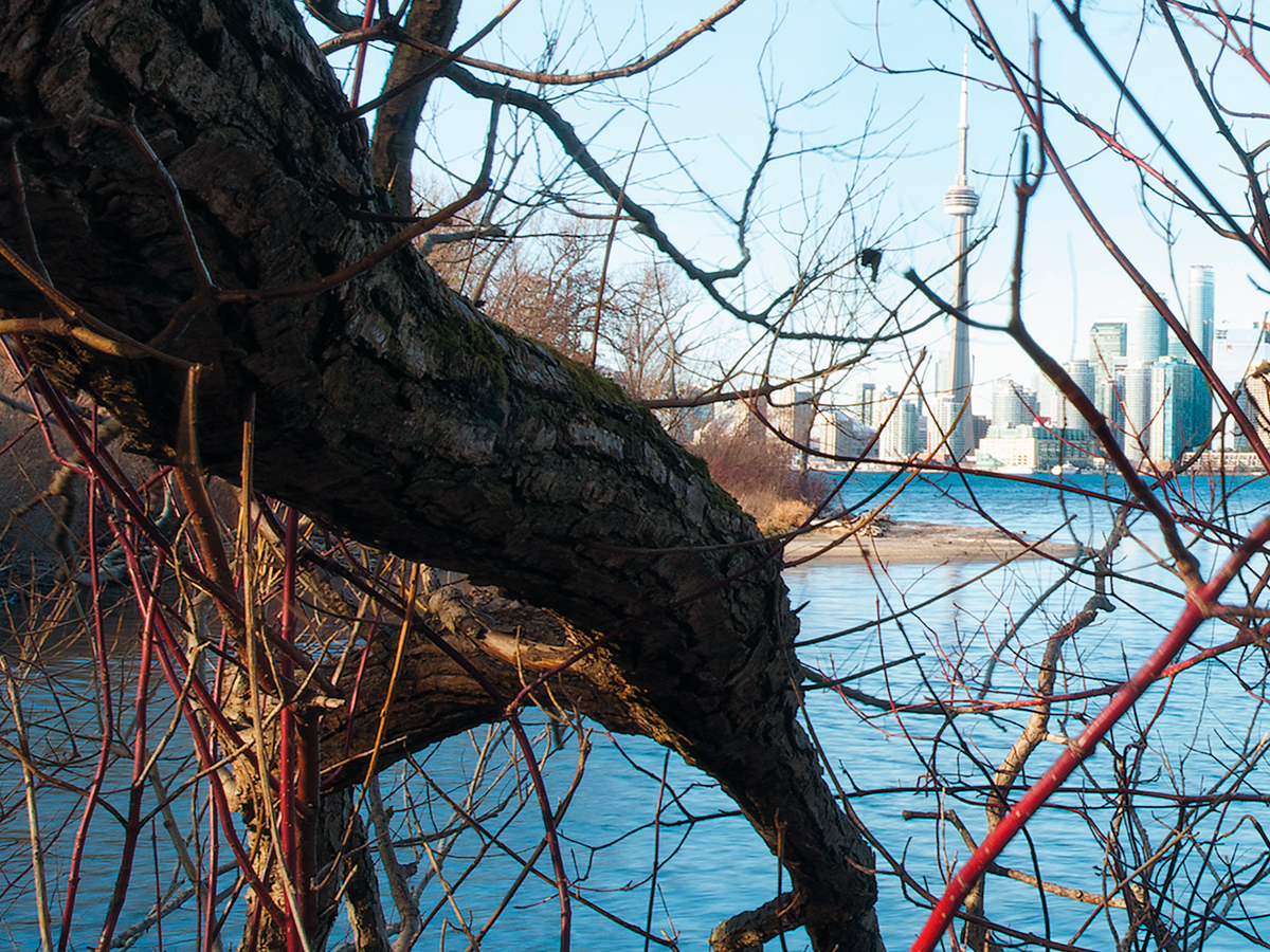
View of downtown from Ward’s Island, Toronto Islands. (Photo by Robert Burley)
The natural parklands found in Toronto’s ravines and along its waterfront constitute one of the largest urban park systems in the world. Not only does the book highlight the beauty of these green spaces; it also serves to underline the importance of preserving them. “It’s a complex message, as we want people to see Toronto’s rich and fragile natural assets, while encouraging them to get out and explore them,” said professor Burley. “But these spaces need special consideration so they may be preserved for future generations.”
According to Jane Weninger, senior planner, strategic initiatives, policy and analysis with the City of Toronto, the project with professor Burley has helped open a dialogue on the subject of the ravines that was otherwise difficult to translate into words.
“The book communicates to the public in a very powerful way,” she said. “I believe the deeper understanding of this subject has only been possible through the unique collaboration between the City, the University and this artist.” The book has helped both city planners and the public at large to become more informed about the value of the natural parklands, she added. “Planners are already embracing the ravine strategy, and it’s in part because of the work we’ve done. There is a growing desire to integrate green spaces into our rapidly growing city in a way that will increase accessibility while ensuring their protection.”
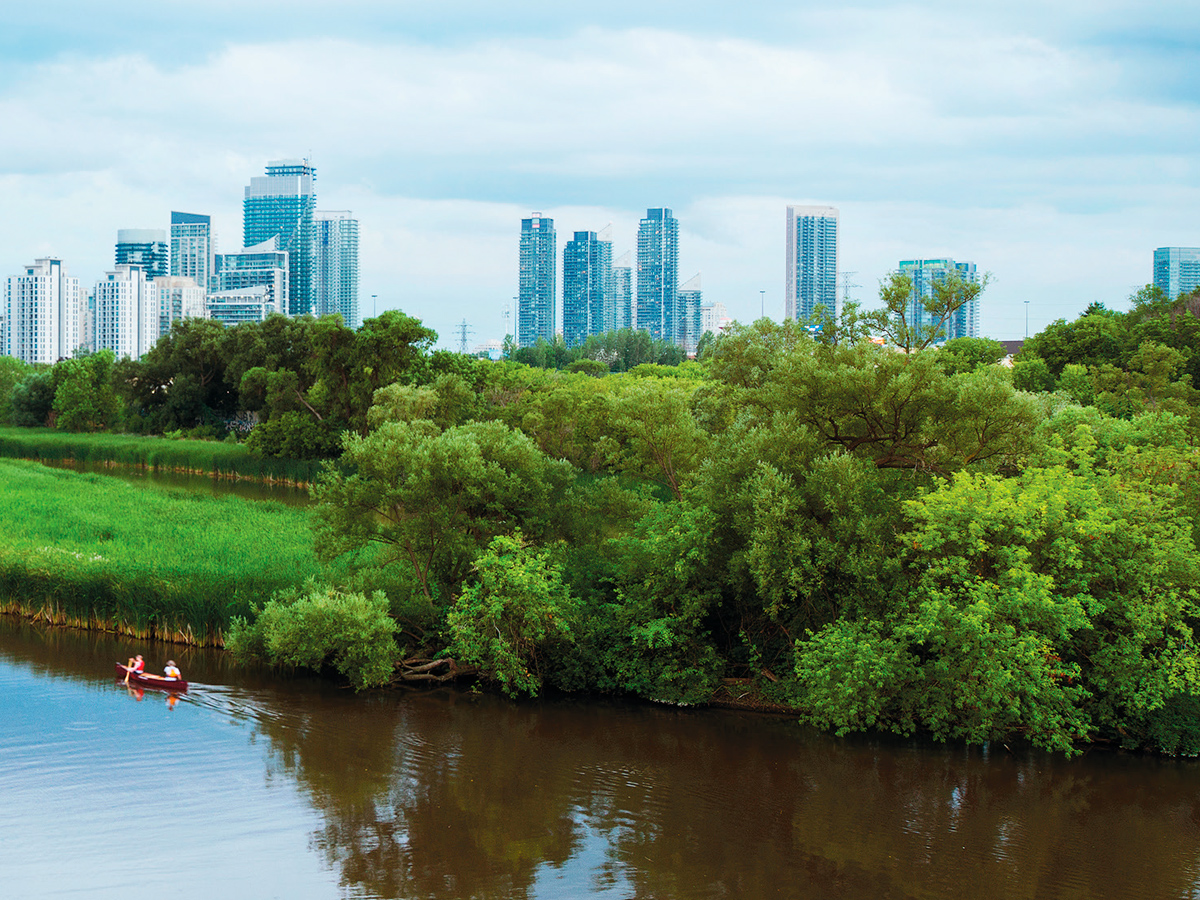
Humber marshes at the mouth of the Humber River. (Photo by Robert Burley)
Professor Burley noted that photography has a long history of changing public perception of public spaces. For instance, in the 1870s, William Henry Jackson’s photographs of Yellowstone National Park persuaded the United States Congress to preserve the park in its natural state and establish the site as the world’s first national park.
“As Torontonians, our green spaces are an important part of our identity,” said Ms. Weninger. “We are trying to reconnect people with the landscape.”
An Enduring Wilderness is available through most booksellers and at the Ryerson Bookstore.