Flood Risk, Environmental Rewards, and the Production of Urban Space in Vancouver
Vancouver’s Burrard Inlet and the Salish Sea offer environmental rewards that draw people for tourism, recreation, and the stunning views. Yet rising sea levels and extreme weather are increasing flood hazards for coastal communities—while governance and capital continue to shift the responsibility for managing these risks.
By now, many of us are intimately familiar with catastrophic natural hazards. Flooding is Canada’s – and the world’s – most frequent and costly hazard (Public Safety Canada, 2022). Hurricane Fiona’s devastation in Atlantic Canada in 2022, or more recently, the flash flooding in Toronto this July, all come to mind. Historic and extreme events are occurring more often because of factors such as sea level rise, weather extremes, and urbanization pressures. To address this escalating threat, understanding how risk is produced and distributed across space, society, and the economy is crucial to equitable adaptation.
With the longest coastline in the world, Canadians rely upon our proximity to the water. Communities were developed for their access to the coast and continue to benefit from this important relationship. Vancouver, situated on the unceded and unsurrendered territory of the Musqueam, Squamish, and Tsleil-Waututh, has long depended on its proximity to the Salish Sea and the outflow of B.C.’s Fraser River.
The relationship between development and the natural environment is complex and dialectical. Today, Vancouver consistently ranks among the most livable cities in the world, in part thanks to its rich natural environmental amenities and valuable waterfront development. However, before the residential towers and seawall, there was the land and water. Identifying how risk has been produced through the historical co-production of the environment and economy is crucial towards understanding the current transformations occurring on the waterfront.
Oral histories in the Coast Salish linguistic group describe stories of flooding that explain the relocation of people swept away from the mainland across vast territory and promote the connection of tribes across the region (Carlson, 2010). Livelihoods relied on the spring floods to regulate abundant resources, and the gently sloping floodplains provided access to productive ecosystems.
The first Europeans reached the Strait of Georgia in the eighteenth century and found a prosperous and culturally complex society. Although it would take time for a colonial market economy to develop, the otter fur trade and gold rush brought early commodification of resources to the region (Harris, 2007). It wasn’t until the 1880s, on the promise of a transcontinental railway, that Vancouver was incorporated. A sawmill and resource processing hub, the deep-water port and rail terminus allowed coastal timber stands to be profitably exported as far away as the United Kingdom. Imports such as silk from Asia pushed high-value commodities through the city and further east. Suddenly, the commercial reach of Vancouver extended its resource hinterland thousands of kilometres away. Vancouver was known as the “gateway to the pacific” or the “front door of Canada” and was uplinked to an empirical network of trade (Bell, 1918, p. 101).
Of course, early Vancouver was not immune to natural hazards. The ironically named Water Street was frequently inundated by coastal storms until the port was infilled. False Creek became a hub of industrial activity, whereby access to ships and proximity to the rail line were highly valued.
The dominant theme of this era was that of taming floods using technocratic, hard engineering solutions such as diking the Fraser River and dredging harbours. Remaking the landscape meant turning marshland into an agriculturally productive form of ‘second nature.’ This continued as the city industrialized, where colonial infrastructure both disrupted the ecological processes and provided easier and more predictable access to valuable resources.
Floods prompted government response according to the paradigm of the time. In 1894, a dramatic spring snowmelt caused the Fraser River to rise over 8 meters above its baseline level. The floodplain was sparsely populated, so the impacts were less severe than they would be today; rather, the flood underscored a landscape not yet tamed by human intervention. According to a 1985 government report, “if properly drained and made safe from inundation by scientifically constructed dykes, it would be very valuable indeed, and could soon be made to pay the full cost of all improvements... It should, we think, be done by the government, or under direct supervision of the government” (Province of British Columbia, 1895, p. 433). Later, the historic 1948 flood spurred the impetus for area’s first regional plan. Public investment, driven by Keynesian economic policies, also promoted flood infrastructure, part of the same politics that enabled highway construction and suburban dispersal in the region.
This continued for much of the 1900s, until Vancouver began its transition from a resource economy to a consumption and service city (Hutton, 2008). Heavy industry relocated to the suburbs where larger complex facilities could transfer cargo more efficiently. Vancouver found itself with undervalued plots of waterfront land.
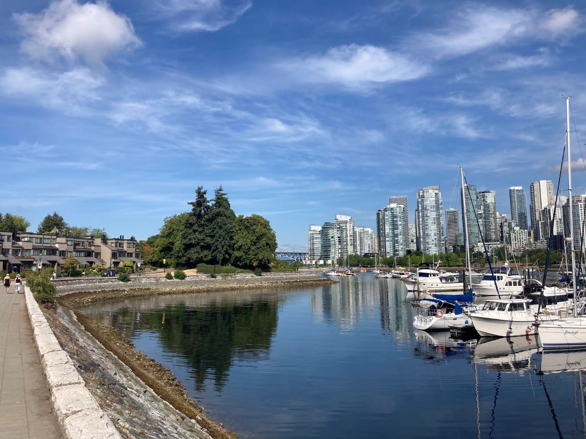
False Creek North, remediated by the provincial government and sold to developers in the 1980s, was a key turning point for the city. This development promoted ‘livability’ and progressive, human-centered urban planning. The seawall provided access to the waterfront for people and cyclists – a public good. Tourism grew, and so did real estate prices.
Along with these neoliberal market-based arrangements of economic growth, responsibility for flood management gradually transitioned from federal and provincial governments to municipalities and individuals. In response, Vancouver asked developers to co-produce the public realm and pay for flood mitigation. As a result, vulnerable groups of people face increased exposure to hazards, while more powerful actors benefit from adaptation measures and shift costs onto society, illustrative of maladaptive intervention or climate gentrification (Oulahen and Ventura, 2022; Taylor and Aalbers, 2022). With sea level rise and intense development pressures set to reshape public spaces once again, whose voice will be heard in the next stage of transformation?
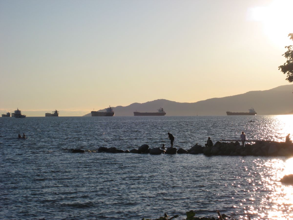
![]()
The False Creek seawall at low tide. This location was once a site of industry and has since been remediated for use by residents and tourists alike.
![]()
Using interviews with the general public in Vancouver’s False Creek and Fraser River floodplains, my research seeks to understand how people perceive the adaptation and governance of flood risk. Specifically, I ask about the values people hold to these waterfront spaces. These insights help conceptualize the extent to which public values align with current flood risk governance.
Participants express a deep appreciation for the natural environments. The study sites provide a sense of place and interconnection to nature. One person from False Creek notes how “a lot of it’s the culture, and what makes this area so great is being by the water.” People acknowledge that the environmental rewards—such as fresh air, access to nature, or the view—outweigh the environmental risks. Many participants perceive the landscape as more “useful” than the “grim” historical context. Nevertheless, people note geographic inequities to waterfront access: “I mean, the rich and the powerful are living over there and controlling that.” There is also a worry regarding the role of developers in reducing flood risk and providing quality public spaces. Can the private sector take a meaningful and moral responsibility for flood risk reduction? One participant from the Fraser River said “people are in business to make money. Maybe we should also be questioning that.”
![]()
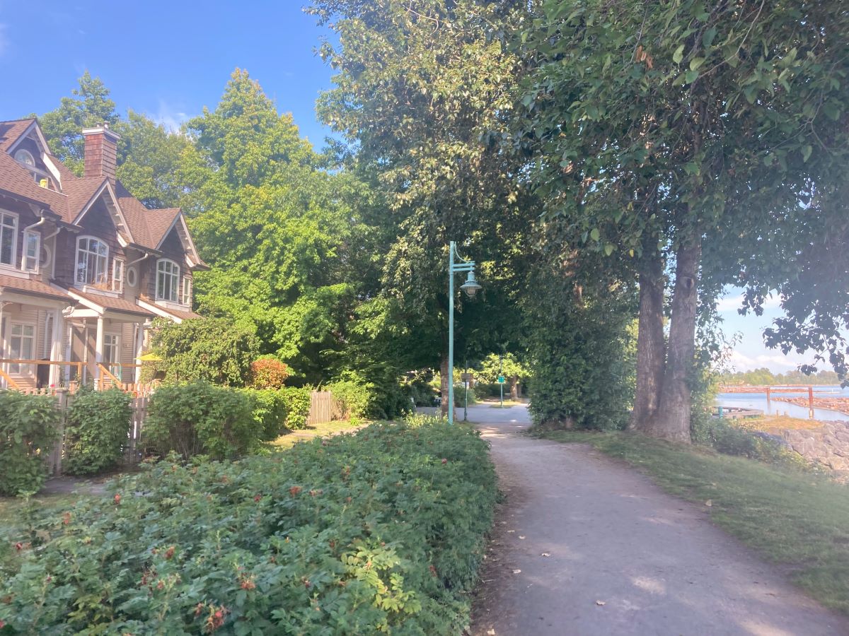
Residential development and a walking path in South Vancouver, adjacent to the Fraser River.
![]()
Vancouver is experiencing immense pressures from climate change and other non-environmental risks. The pressures driving urbanization, combined with real estate challenges, concurrently exacerbate flood risk. These issues are not unique to Vancouver – the intersection of capital, hazards, and society is deeply entrenched in places across the world
A creative shift in how we approach adaptation – challenging both private involvement and past paradigms of control and commodification over nature – may offer the best strategy for those living with the risks and rewards of waterfronts.
![]()

Under the supervision of Dr. Greg Oulahen in the Department of Geography and Environmental Studies, my research draws on natural hazards literature to better conceptualize the social, political, and economic factors involved in the production of flood risk. I use multiple and mixed methods, such as historical geographic materialism and semi-structured interviews, to mobilize equitable climate adaptation. Prior to my MASc, I completed a Bachelor of Arts in Environment and Urban Sustainability at TMU and held research assistantships investigating flood risk, resilience, and environmental rewards on Toronto Islands.
Questions about the article? Contact Chris Randall directly at: c3randall@torontomu.ca