Opportunities
Join Our Research Team
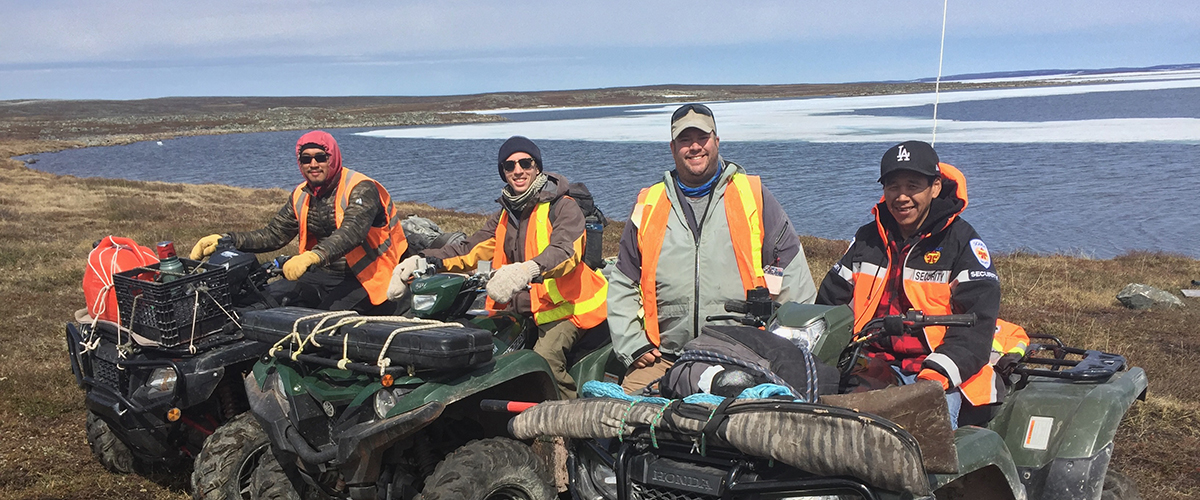
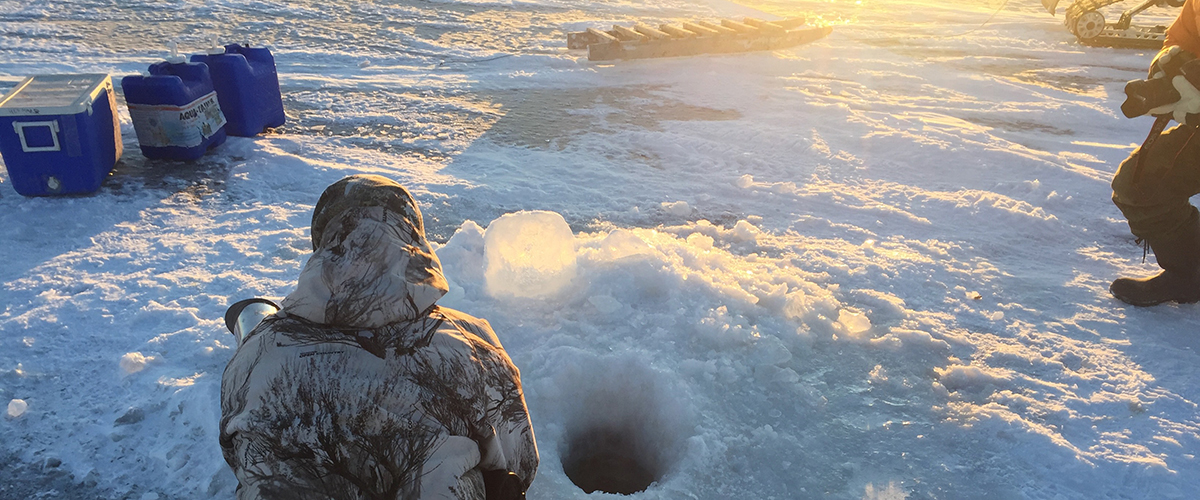
Geospatial research in Arctic and Indigenous-partnered projects
Dr. Atkinson and the PolarSEAL research group are committed to the principles of Justice, Equity, Diversity, and Inclusion (JEDI). We welcome people of any ethnicity, ability, gender, and sexual orientation to reach out to us about our research.
Master’s Students – Arctic & Indigenous-Led Research
We are seeking Master’s students to participate in field-based research across Arctic and Indigenous community sites. Projects focus on:
Landscape and water quality monitoring
Participatory mapping and Indigenous knowledge integration
Remote sensing and RPAS-based vegetation and terrain mapping
Students will gain hands-on experience in environmental data collection, geospatial analysis, and drone-based mapping, while working closely with Indigenous communities and multidisciplinary research teams. Opportunities include contributing to publications, presenting findings, and building community-centered research skills.
Requirements:
Bachelor’s degree in Geography, Environmental Science, or a related field
Interest in Arctic, conservation, or Indigenous-led research
Experience with GIS, RPAS/remote sensing, or spatial analysis preferred
Application:
Send a statement of interest, CV/resume, and transcripts to Dr. David Atkinson (datkinson@torontomu.ca).
PhD Student – Arctic Remote Sensing & Ecosystem Modeling
We are seeking a PhD student to advance research in Arctic ecosystem monitoring and high-resolution geospatial modeling, focusing on:
Multi-sensor RPAS mapping and LiDAR analysis
Object-based image analysis (OBIA) for vegetation and terrain classification
Monitoring changes in permafrost, vegetation, and water systems
Integrating traditional knowledge with quantitative geospatial methods
This position offers opportunities to collaborate with Indigenous communities, engage in international Arctic research networks, and contribute to high-impact publications. Students will gain advanced training in remote sensing, digital terrain modeling, and participatory mapping approaches.
Requirements:
Master’s degree in Geography, Environmental Science, or related field
Experience with GIS, RPAS, LiDAR, or OBIA preferred
Strong quantitative, analytical, and academic writing skills
Application:
Send a statement of interest, CV/resume, and transcripts to Dr. David Atkinson (datkinson@torontomu.ca).
PhD Student – Indigenous-Led Conservation & Traditional Food Systems
We are seeking a PhD student to join our research program in Indigenous-led conservation and sustainable land management. The student will focus on:
Participatory mapping and integration of Indigenous knowledge with spatial and ecological data
Monitoring and modeling traditional food systems, including culturally significant plants and wildlife
Remote sensing and RPAS-based vegetation and terrain mapping for conservation planning
Supporting community-led stewardship and sustainability initiatives
This position provides hands-on experience working with Indigenous communities, advanced training in geospatial technologies, and opportunities to contribute to publications and policy-relevant reports. Students will gain experience combining cutting-edge spatial analysis with community-driven approaches to achieve meaningful conservation outcomes.
Requirements:
Master’s degree in Geography, Environmental Science, Conservation Biology, or related field
Experience with GIS, RPAS/remote sensing, or spatial analysis preferred
Interest in community-based participatory research, Indigenous knowledge integration, or conservation
Strong analytical, research, and academic writing skills
Application:
Send a statement of interest, CV/resume, and transcripts to Dr. David Atkinson (datkinson@torontomu.ca).
Note: Due to recent changes in international student visas, there is currently limited opportunity for international students.
Graduate Programs
Interested students should examine our graduate program options:
Master of Spatial Analysis (MSA) (opens in new window) is a 12‑month professionally oriented master’s program that trains students to “think geographically.” Through project‑based courses, labs, a practicum (internship), and a major research paper or thesis, students master Geographic Information Systems (GIS) and spatial analysis for real‑world decision‑making.
Graduates go on to careers in urban planning, environmental consulting, resource management, marketing, public health, transportation, social policy, and more — wherever spatial data, mapping, and location analytics can influence outcomes.
Environmental Applied Science & Management (MASc/PhD) (opens in new window) at TMU is an interdisciplinary graduate program that combines environmental science, policy, management, and applied technology to address real‑world environmental challenges. Students draw on expertise across diverse fields — from ecology, urban planning, engineering, and public health to social sciences and policy — to design research that spans water quality, pollution control, ecosystem management, climate change, GIS/spatial analysis, and more.
Master (MASc): Normally 2 years full‑time (or part‑time over longer). Students choose between a thesis track or a professional/project track. Thesis students take core + elective courses then complete an original research project and defend a thesis; project‑track students complete coursework and an applied environmental project.
PhD: Typically 3–6 years full‑time. Coursework is minimal (4 courses), with the main focus on developing a research proposal, passing a candidacy exam, and producing a dissertation. Students build expertise in environmental applied science, management, and policy through advanced research.
The program is designed to support candidates from a variety of backgrounds (biology, geography, engineering, urban planning, public health, etc.) and equips graduates with the skills needed for academic research, environmental consulting, government policy, resource management, and interdisciplinary environmental problem‑solving.