Research in the Spatial Ecology Lab
Our lab researches the impact of environmental stressors on species and on ecological functions. Specifically, we take a spatial analytical and geo-computational approach that lets us find patterns across multiple scales. We’re one of only a few labs to take a combined land-water lens to ecological problems.
We draw on large datasets with spatio-temporal components (e.g. climate, socio-economic and environmental monitoring network data, land cover maps). From these, we build theoretical and empirical models of species distributions and compound environmental variables. Ultimately, our work aims to inform real-world strategies for responsible environmental stewardship.
Below are some of our research interests, including our latest direction in Urban Ecology and our ongoing research in Spatial Ecology.
Spatial Ecology

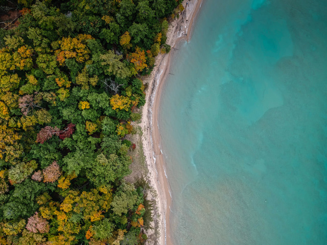
We study ecological problems not only within terrestrial or aquatic systems in isolation, but often in combination. By using a dual-lens, land-water approach, we can explore environmental problems in a more comprehensive, integrated way.
For example, we developed spatial statistical models to examine forest disturbances and management practices in relation to fish mercury levels in lakes across Ontario. We worked with collaborators in the Global Lake Ecological Observatory Network (GLEON) (external link) to assemble and analyze regional and global datasets on impacts of land-based climate change on lake temperatures at different depths. We are also co-participants in another novel GLEON initiative to conduct simultaneous mesocosm experiments looking at impacts of road salt on pristine zooplankton communities at 16 lakes around the world.
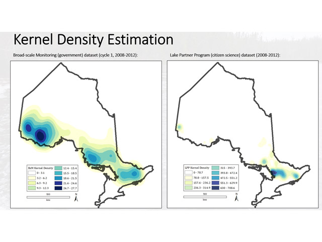
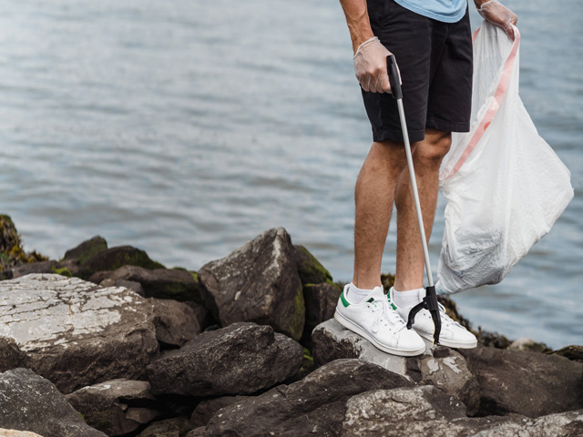
Making the best use of research funds often starts with knowing where to source samples. In the context of ecology, this often involves targeting the most biodiverse areas — for example, those with the most fertile soil or richest concentration of animal species. Our lab works on sampling strategies for international environmental monitoring networks.
Some of our projects include a technique that uses pollen movement to locate rare plant populations, a model decision-support tool for optimizing the location of road weather information systems (RWIS), and an investigation into spatial bias in lake monitoring programs involving volunteer citizen science efforts versus professional monitoring.
Urban Ecology
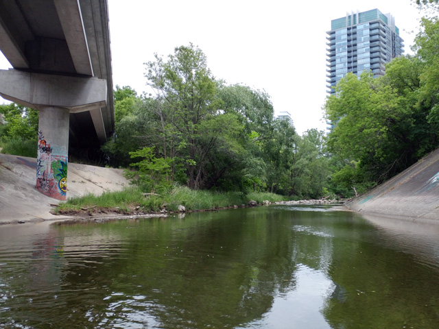
Urban watershed form is the combination of elements — such as developed land, greenspace, riparian cover, and natural or engineered waterbodies/watercourses — and the way they’re configured across a drainage area. Our lab is studying those physical characteristics, and how they impact biodiversity (e.g., birds, mammals and insects) across scales.
We use geospatial analysis to examine available data on species richness patterns in urban areas. We want to understand how diversity relates to factors such as human population densities, distance to waterbodies and elevation. We’re also using spatial analysis, and water flow pathways to model the spatial configuration and downstream impacts of land-based stressors and land uses. Understanding how watershed form affects species richness patterns can help urbanites prioritize and design habitats that suit the many species we share our environment with.
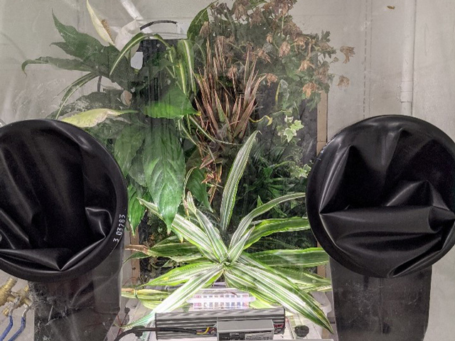
In tandem with our research on urban watershed form, we investigate how form modulates urban water metabolic functions. Examples include oxygen exchange, changes in humidity, and contaminant processing functions performed by aquatic systems and microbiomes (i.e., water-based plant, bacterial, and fungal organisms). We’re specifically interested in how urban watercourse form relates to these metabolic functions — and how this ultimately impacts air quality.
To that end, we use three methods: experimentation using a hydroponic green wall system located in the Centre for Urban Innovation; mensurative experiments to measure and relate changes in end-result variables like air quality or species richness with changes in urban watershed form; and spatial modelling to upscale model results and examine predicted impacts.
"Urban form, biodiversity, and watercourse functions are influenced by complex human factors. Some of these include socioeconomics, socio-cultural dimensions, and human behaviours. Our lab uses spatial analyses to study patterns of human behaviours in order to understand how all of these factors are related.
Depending on how humans perceive the state of local biodiversity, they may participate more — or less — fully in responsible stewardship of their urban watershed. Such actions may include willingness to attend public meetings, join stewardship groups, and reduce waste that goes down the drain. Ultimately, our goal is to translate knowledge about urban watersheds — its form, function and biodiversity — into actions that humans can take as stewards of the natural environment.
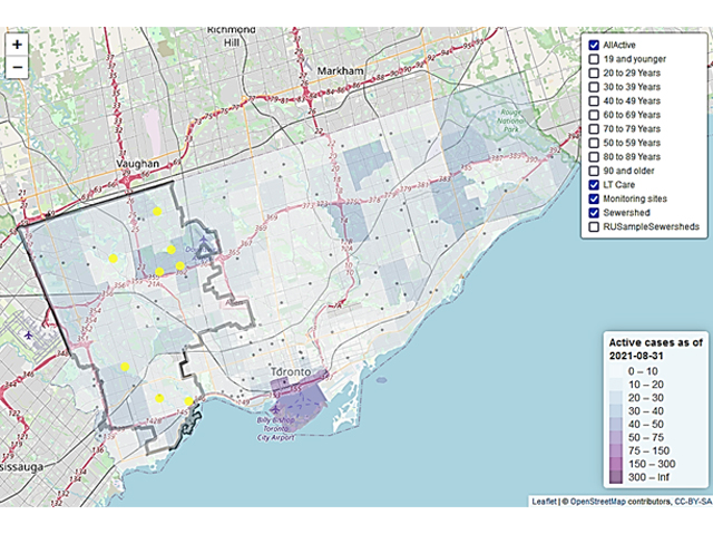
Wastewater can be a valuable source of data, including providing insight into virus levels within a community. Even where people are not tested for COVID-19, virus levels are still detectable in wastewater based on viral RNA shed through human stools. Our lab is working with leads at Ryerson’s Urban Water Research Centre, Public Health Ontario, Toronto Public Health, and Toronto Water to conduct COVID-19 wastewater surveillance in the City of Toronto.
Through geospatial analysis, we are exploring correlations between COVID-19 case data and variables such as age group, neighbourhood, socioeconomic factors, and environmental air pollutants. The research aims to provide early detection of trends, such as spikes in case counts in a given neighbourhood, and to inform decisions such as where to sample sewers.
Knowledge and Technology Translation
Our lab contributes to the development of software code for R statistical packages. Such spatial analytical tools are used in government departments, such as ministries of natural resources, meteorological institutes, and in government monitoring programs.
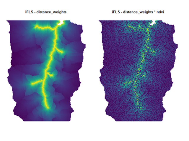
We contributed to the conceptual design of the R package hydroweight (external link) , which allows environmental scientists to ‘weight’ the importance of upland land cover contributions (e.g., intensive agriculture with excess nutrient loads) based on water flow pathways using WhiteboxTools. View the latest version on Github (external link) .
We also contributed to the development of functions and code for other R packages, intamap and intamapInteractive. These provide additional tools to optimize sampling designs for monitoring environmental variables by minimizing spatial interpolation errors. View details about intamap (external link) and spatial simulated annealing (ssaOptim) on rdrr.io (external link) .